Click on the map images to download a high resolution version.
Map of the Lesser Slave Watershed

Human Footprint in the Watershed

*note that the cutblocks in this map are the total area harvested over time, the data set does not account for forest regeneration so the footprint is not the same across the harvested area. ABMI is working on a data set that does account for regeneration and adjusts the footprint accordingly. LSWC maps will be updated when this information is available.
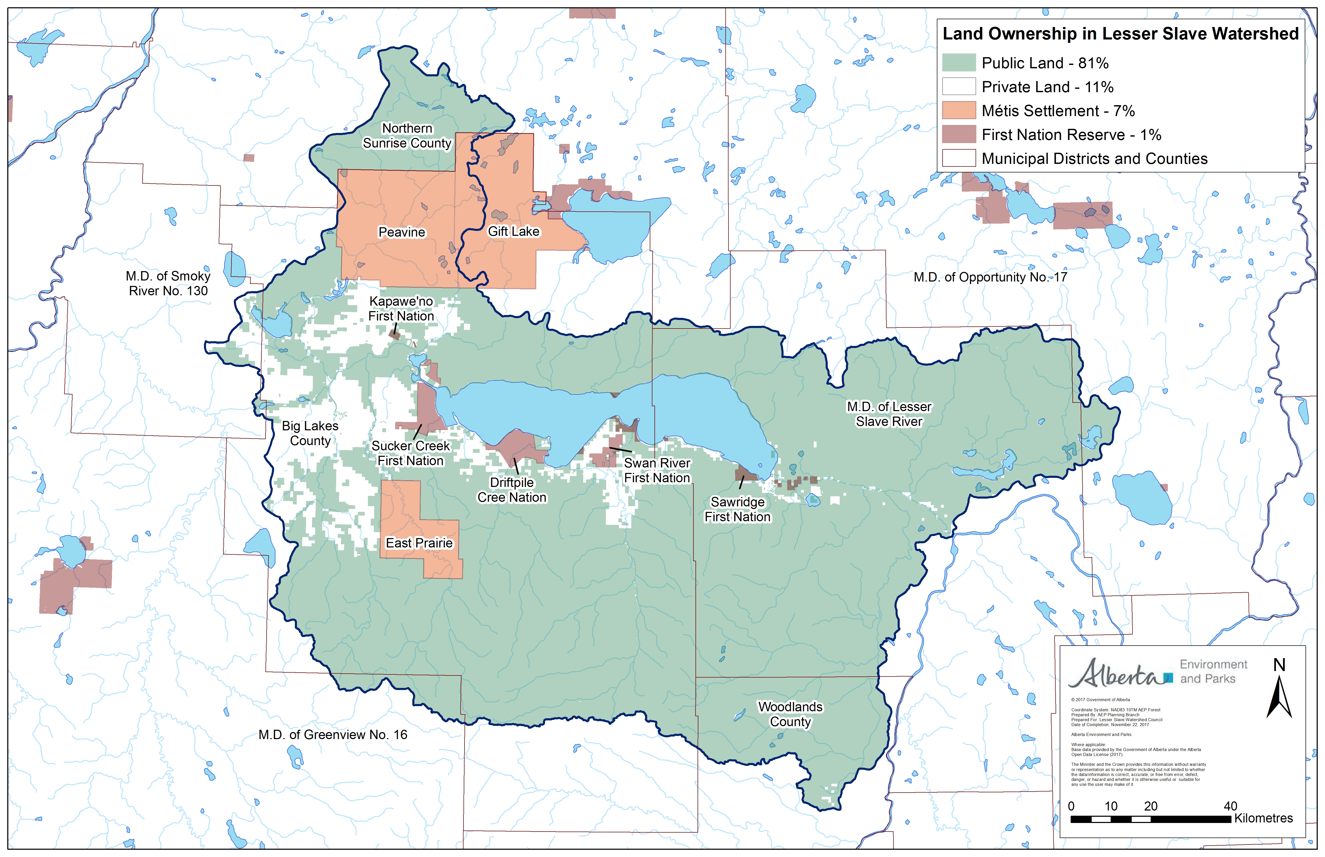
Land Ownership in the Watershed
Wetlands in the Watershed

Additional Maps and Resources
Free GIS data is available from the Government of Alberta. Click HERE for access
Big Lakes County maps can be found HERE
MD of Lesser Slave River Maps can be found HERE